Oleg:
Will the height/mesh data of the terrain mesh be accurate? How accurate will it be approximately...anything like Real Scenery or VFR Scenery add-ons that are available for MFS? Is there a possibility for you to update/improve that data in the future (or for users/third-party to do it)?
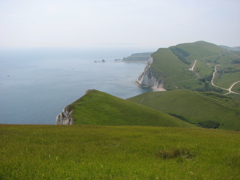
Hills are relatively small in that region of England, so it would be nice to see them as accurate as possible, to give a feeling of realism.
---------
---------
For those not familiar with the terms:
FAQs from Just Flight's webpage:
"Q. What is terrain mesh and elevation data?
A. The visual scenery you see when flying in Flight Simulator is all built upon a basic framework (a 'mesh') that represents the height of the ground at any point in the world. This provides the three-dimensional relief model of hills, mountains, valleys, cliffs, depressions, plateaux and so forth, upon which all other scenery objects and ground textures are placed. The vast majority of the area of the default relief model of England and Wales in Flight Simulator X is set at 76m between each reference point so this means that there are no relief detail changes between points 76m apart. This creates a very "soft" terrain where mountains that should be craggy appear as smooth rounded hills and individual features that fall between the points are lost completely.
VFR Real Scenery includes reference points that are just 9.6m apart which provides a far higher resolution than the default. Even small ground features now become visible."